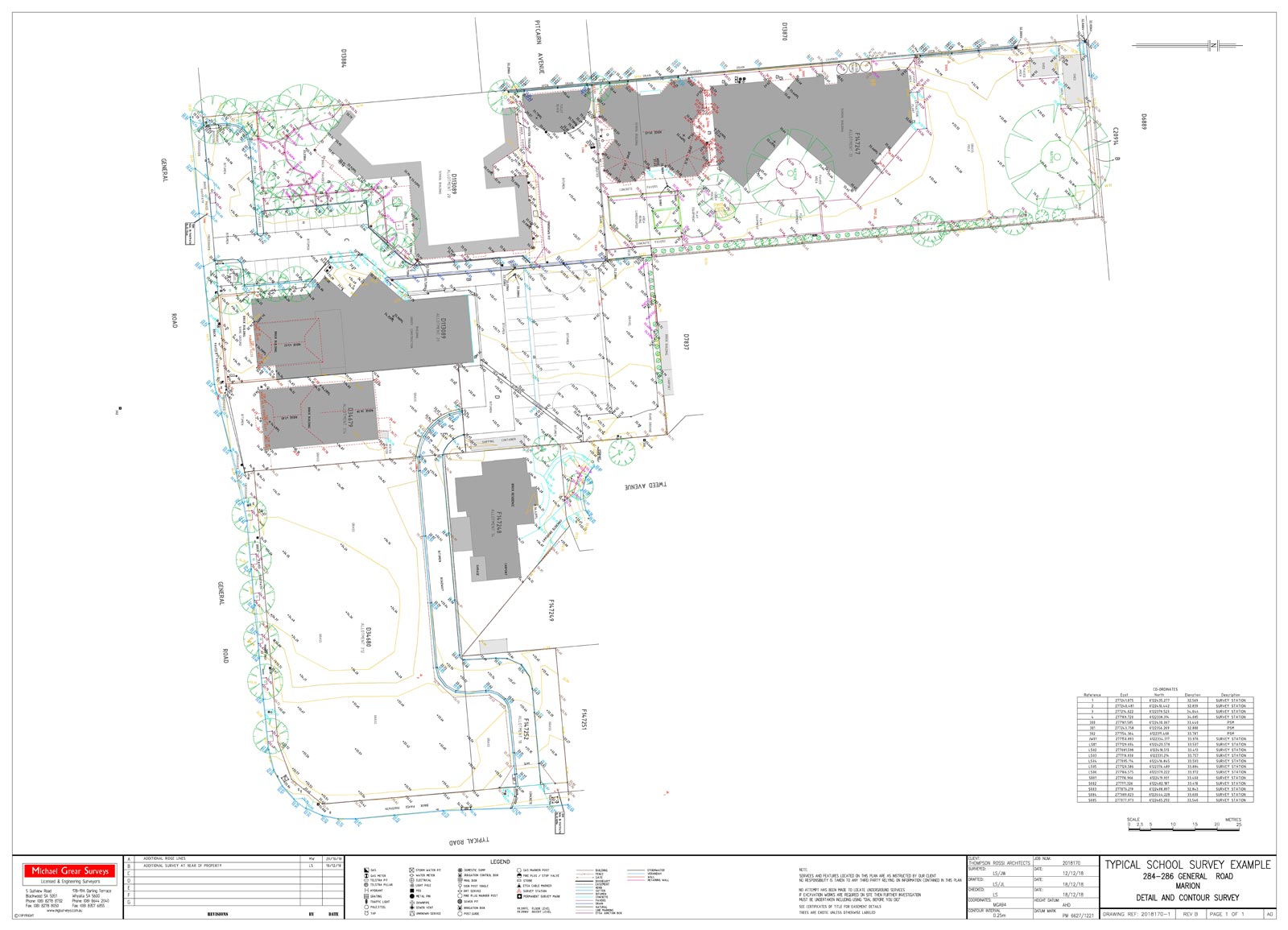
Topographic or” Detail” Surveys are used in many situations where Architects , Designers or Engineers need to know the current physical situation in terms of features and levels of the site in question. This survey is then used to design buildings, extensions, roads, bridges, schools, factories, wineries, pipes, dams, subdivisions, almost anything that is built,

Not only above the surface but underground services can be detected and modelled in 2D and 3D providing the complete picture of what is there to give certainty in design.

Example plan of Topographic Survey

Topographic Survey

What our clients say

We are very happy with the service provided by your company & will recommend you to future friends/ family etc.

N Elliott

Thank you for your help. Very professional and punctual.

E McGowan

Fantastic service, easy to contact and plenty of updates throughout. MG surveys were the most reliable part of the boundary alignment/sale process for us.

T Modra

Easy to deal with and good communication.

M Montgomery

The whole service was great, from start to finish. 

T Duggan

When designing a building project, accurate detailed site information is critical. Michael Grear Surveys are always my starting point because I know that I can rely on all aspects of the service provided.

Richard Simmons

I really appreciated the quick action and help that you and your team have provided to have this project completed.

G Standing

You guys were awesome to work with! Thanks so much for being patient and understanding to someone who knew nothing about Land Divisions.

D Vaughan

Get in touch with us

Adelaide Office

  5 Gulfview Road, Blackwood SA 5051
  08 8278 8732  
  admin@mgsurveys.com.au

Whyalla Office

  37 Patterson Street, Whyalla SA 5600
  08 8644 2040  
  whyalla@mgsurveys.com.au

Send a quick message

Please let us know your name.
Please let us know your email address.
Please write a subject for your message.
Please let us know your site address
Please let us know your message.
Invalid Input
Invalid Input